About
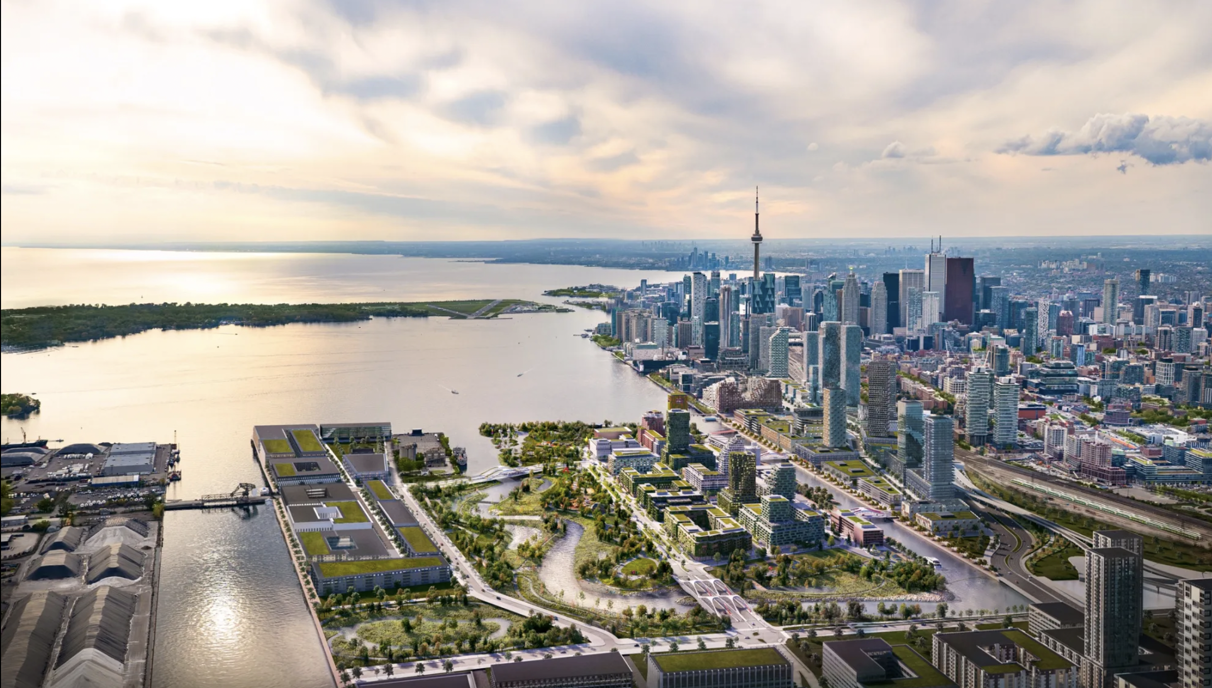
The development is located at 115 Saulter Street South. The vision for the site is to develop a modern mixed-use development that compliments the evolving neighbourhood of the McCleary District while also paying homage to the unique history of the Port Lands.

Location
Located at 115 Saulter Street South, the site sits at a dynamic intersection of four future streets, offering exceptional connectivity and visibility. It is easily accessible by foot, bike, and public transit, with the upcoming Ontario Line set to further enhance links to the downtown core.
Future extensions like Broadview Avenue and Villiers Street will bring transit-oriented and walkable connections, while a new retail-focused street to the south will add vibrancy. Framed by generous landscaping and a city-owned plaza, the site offers a rare blend of access and openness.
Urban Cultural Living
Just steps from the Distillery District, the location provides immediate access to one of Toronto’s most vibrant cultural hubs, rich in heritage, dining, and arts. Residents and visitors alike can enjoy a wide range of neighbourhood amenities, including cafes, parks, waterfront trails, and local shops—all within walking distance.

Connection & Convenience
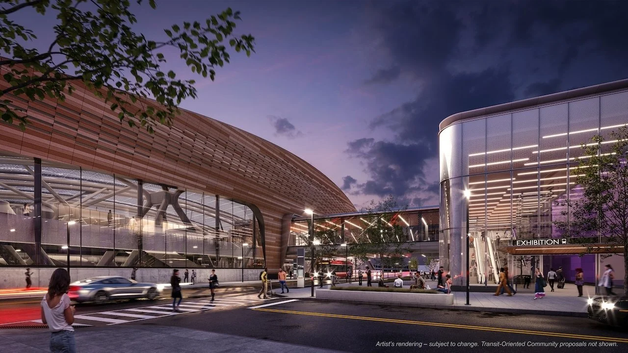
The Ontario Line is one of the Province's large transit infrastructure projects being design and built in the City of Toronto. The Ontario Line will run from Exhibition Stadium (Ontario Place), east through the downtown area and north to Eglinton Avenue near the Don Valley Parkway.
One of the proposed stations is East Harbour. This future transit stop will allow future residents to walk (or streetcar) to East Harbour and travel west to Exhibition Place or as far north as Eglinton Avenue.
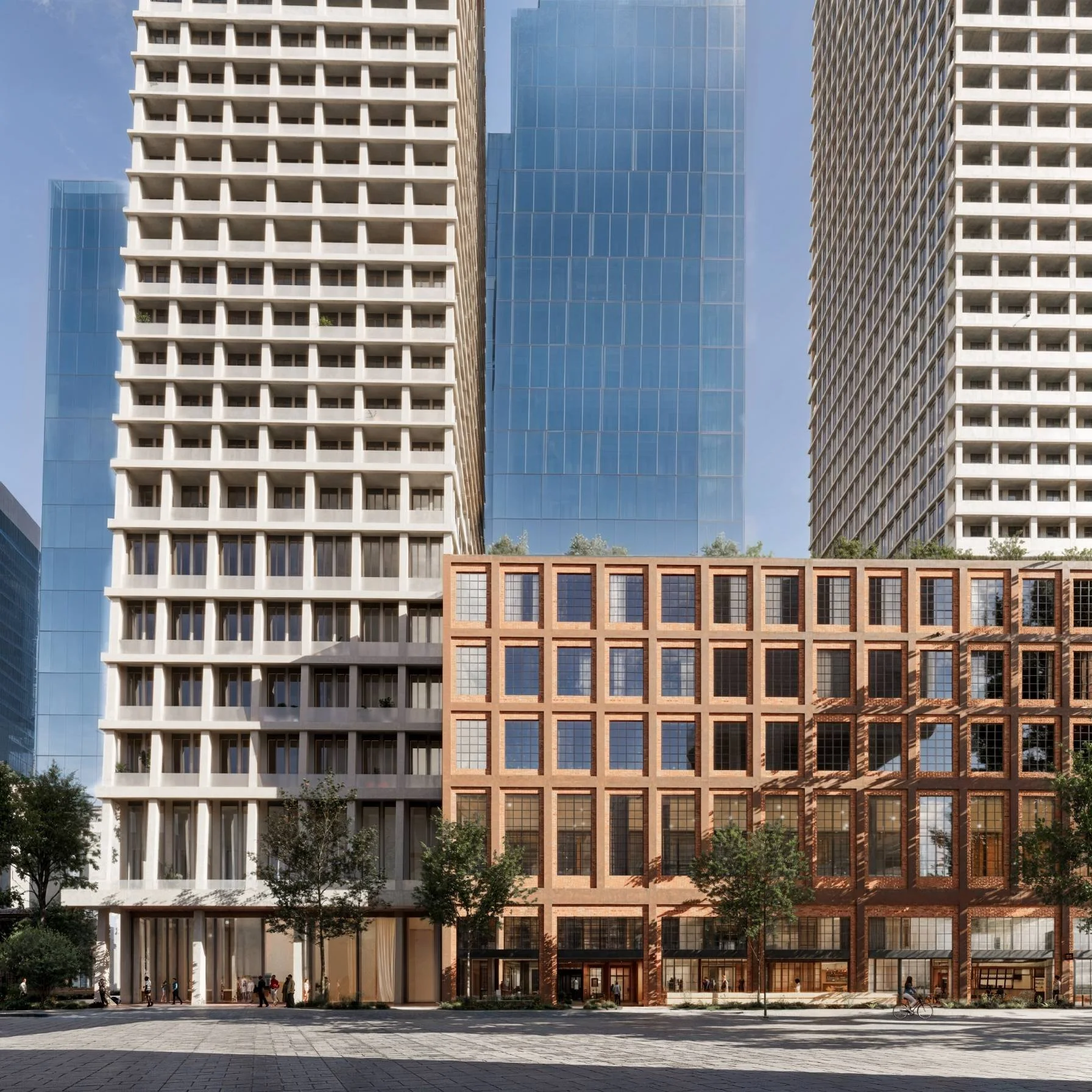
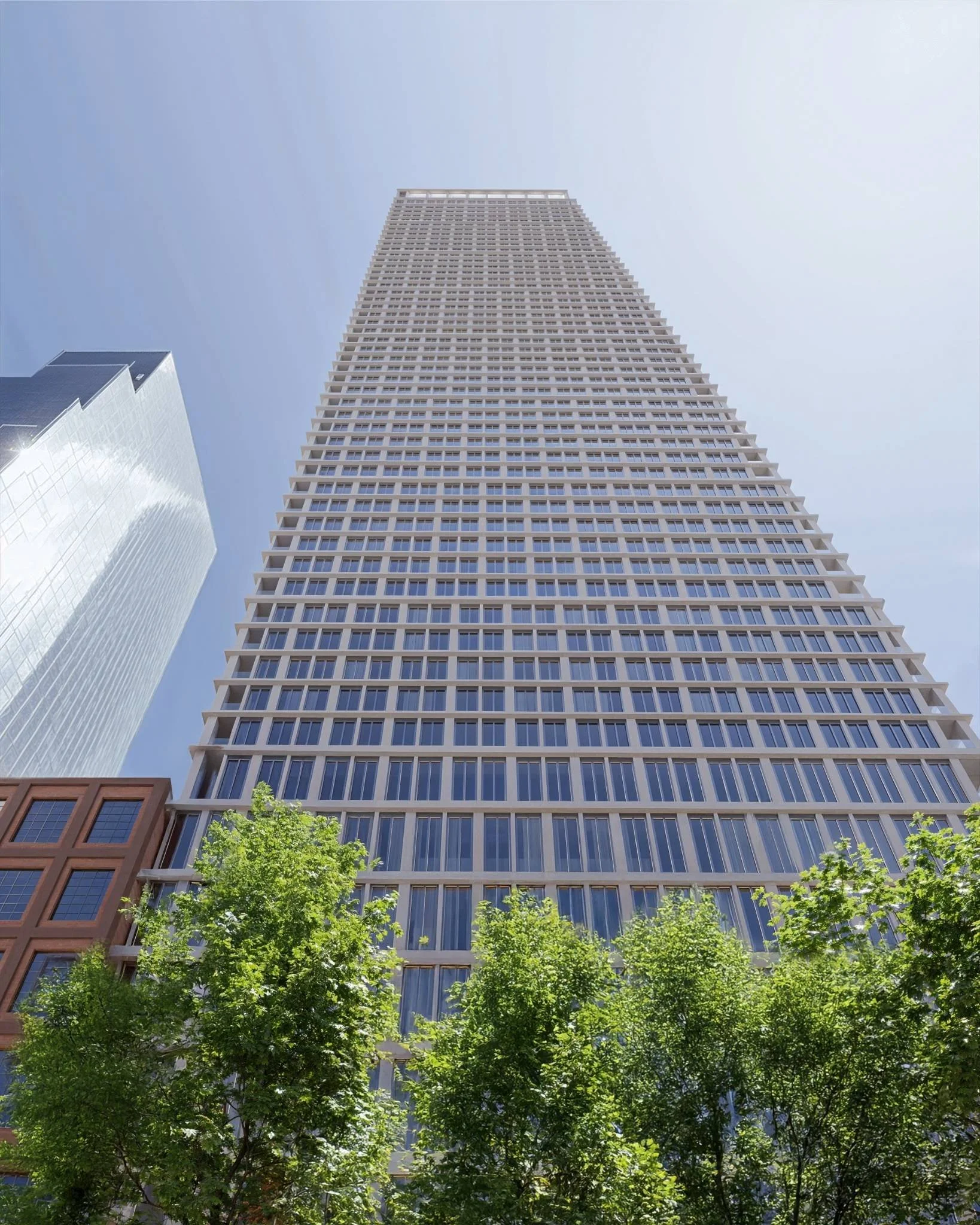
Iconic Smokestacks
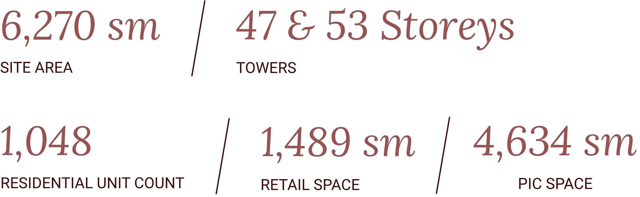
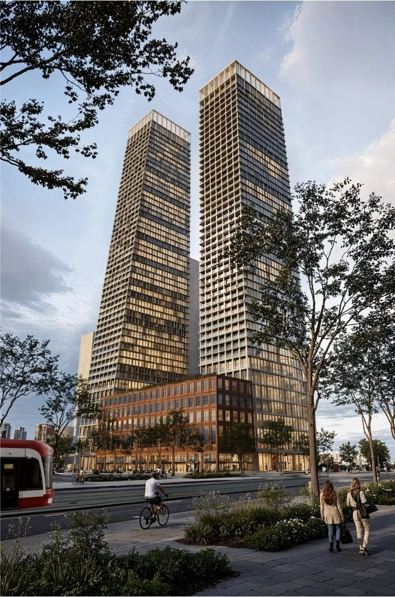
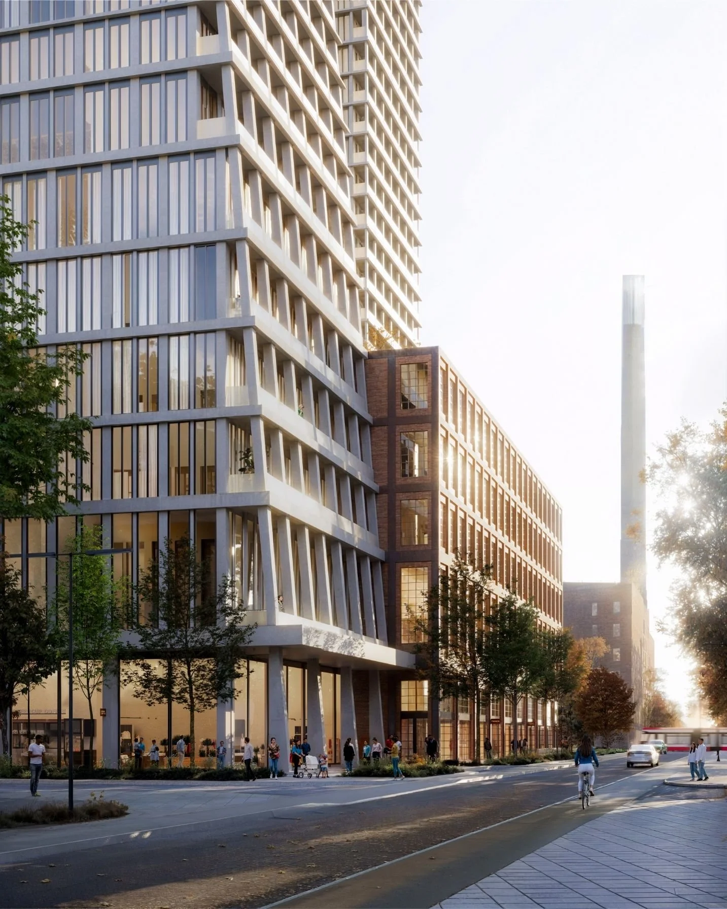
The towers, rising 47 and 53 storeys tall, are designed with a slanted façade to resemble the iconic smokestacks located throughout the Port Lands.
The development proposal includes 2,000sm of interior and 2,200sm of exterior amenity space. The plans feature an outdoor internal courtyard which provides a central location and connect the buildings. The other outdoor amenity spaces will be located atop the bar buildings designed for ideal efficiency, while allowing future residents to connect with their surrounding neighbourhood.
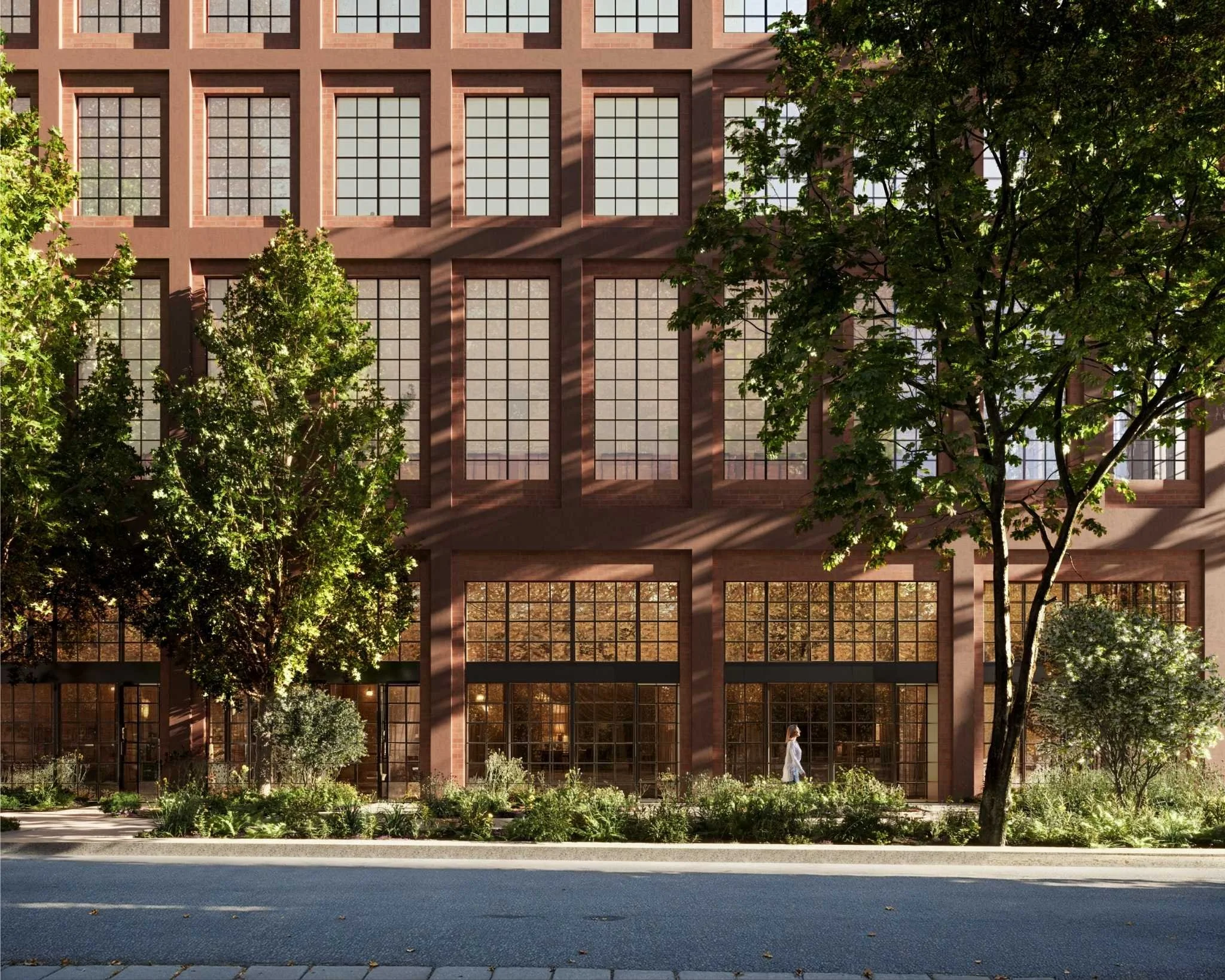
Industrial Heritage
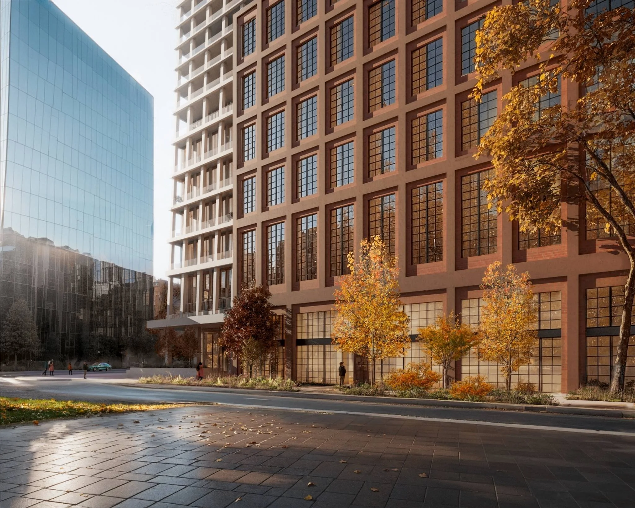
The 5 and 6 storey bar buildings on the north and south side are envisioned to be a rustic red colour, similar to several historic buildings nearby such as The Hearn Generating Station, The Commissioner's Street Incinerator Plant, Cherry Street's Toronto Hydro-Electric System building and Basin Street's former Sun Oil Company building.
Production, Interactive, and Creative
The proposed PIC (Production, Interactive, and Creative) space will deliver 4,600 square metres of flexible, purpose-built environments for studios, workshops, and creative offices—designed to support a wide range of production and innovation-focused uses. These uses will complement the established film and creative industries in the Port Lands, reinforcing the area’s role as a growing hub for culture and film.

Shaping McCleary with Leading Design Teams
Developer Castlepoint Numa is working with some of the world’s leading architects and designers—Design Architect Cobe, Architect of Record and Planner SvN Architects, and Landscape Architect CCxA—to build a future-focused development that aligns with the McCleary District’s transformation while reflecting the Port Lands’ historic identity.
History of Port Lands
The Port Lands were created in the early 20th Century by filling in Ashbridges Bay as a response to an increased demand for industrial sites. Before the conversion, the area was the largest march on Lake Ontario - acting as a fishing ground and gathering place for Indigenous People who lived and travelled in the region.
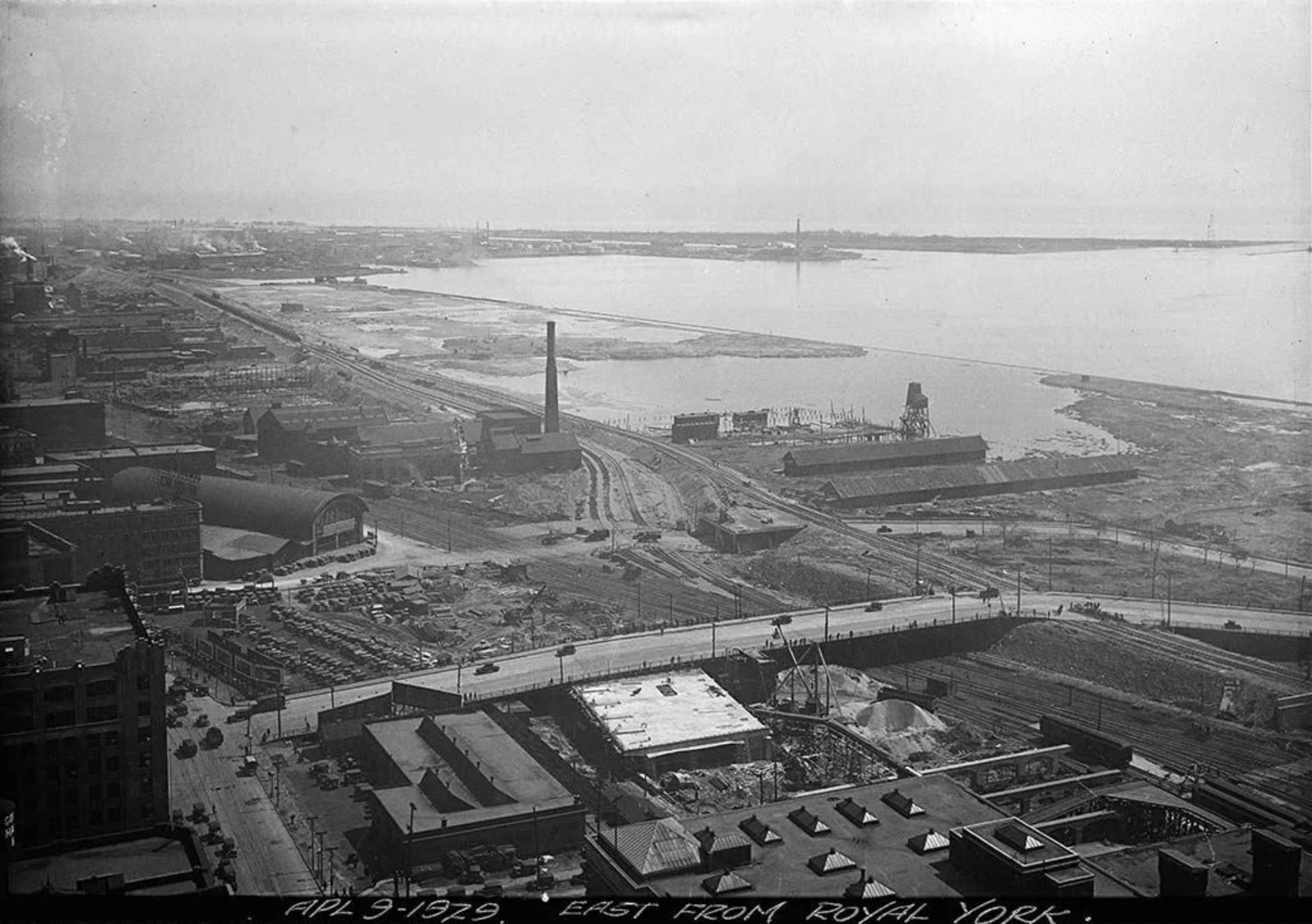
Port Lands Transformation
he Port Lands, spanning 880 acres, are uniquely situated south of the developed area along Lake Shore Boulevard. Bordered by Lake Ontario to the south and west, the area has an island-like character, surrounded by water on two sides.
Waterfront Revitalization
The Port Lands Planning Framework (PLPF), Port Lands Official Plan Modification (OPM) and Ookwemin Minising Precinct Plan were adopted by City Council on December 8, 2017. The planning framework provides structure and guidance on urban redevelopment within the Port Lands and ensures all development will support long-term City building objectives.
115 Saulter Street is located within the McCleary District - the McCleary District precinct planning process is being led by CreateTO in collaboration with City staff and Waterfront Toronto. The Precinct Plan's objective is to establish local street and block patterns, location of parks and open spaces, detailed urban design and streetscape design and recommendations for sustainability and affordable housing. The McCleary District Precinct Plan is anticipated to be adopted by City Council in Q4 2025.

Project Timeline
December, 2022
Castlepoint Numa acquired the 1.53 acres of lands in the McCleary District.
October, 2024
On October 23rd, the four private land owners attended the Waterfront Toronto Design Review Panel and presented their project vision and updates. The panel provided comments based on their professional opinion for the land owners to consider and include in future application submissions. Precinct plan to be adopted by council in Q4 2025
December, 2024
The McCleary District Precinct Plan team hosted a public community meeting on December 10, 2024 to provide updates to the public on the Precinct Plan status and private land owner. The four private land owners fielded questions from the public and provided them with updates on their planning approval timelines and vision for their development sites.
Q1, 2025
Castlepoint Numa obtained the OPA/ZBA